Overview
Map

Introduction
The scenic trail "Dolomieu" is a hike that starts in the locality of Rio Gere and heads toward the "Rifugio Faloria," a mountain lodge that's also a scenic point on top of Mount Faloria. From here you will see a breathtaking view of Cortina and the valley.

This hike can be found on Tabacco Map 003, "Cortina d'Ampezzo e Dolomiti Ampezzane," and goes along Path 212. Alternatively, you can see our route on Google Maps by clicking here.
The scenic path "Dolomieu" is an amazing alternative to reach the top of Mount Faloria, without using the cable car, but it's only recommended for trained people that are used to walking in the mountains.

Path of the hike
The panoramic trail dedicated to Déodat de Dolomieu starts in the big parking lot of Rio Gere and goes along the same path of the chairlift, in this first part. To reach Rio Gere you should use your car, but below on this page you'll find the section "how to get there" with more info and alternative means of transport. If you are unsure of how to reach it, we will describe it in depth down on the page in the chapter "How to Get There."

The first part of the route is along a very wide and clearly visible gravel road. You have to reach the upper part of the car park and you'll find the starting point behind the building which is the departure point of the chairlift, which is active only in winter.

Being a newly built trail, the path is well signposted and the road surface, in this first part, is very smooth, also because this is a ski slope in winter.

After about fifteen minutes of walking along the white road, you will find a sign indicating the official start of the Panoramic trail "Dolomieu" 212, just before the "Pista Bar Pian Bigontina." This is a bar, reachable with a short deviation, where you can stop to eat something for breakfast or drink a coffee before the hike, but in lower season it may be closed.

Forgive the pun, but the first part of the "Dolomieu" panoramic trail is not panoramic at all, as it climbs along the forest of Mount Faloria. You follow a nice stream of water, walking in the woods for about 40 minutes.

At a certain point you cross a gravel road for vehicles, remember to keep right along the path and get ready, as the first steep climb awaits you.

The reward for this climb is the first scenic point of the hike. There is a narrow bend in the path, take the short detour to the right, from which you will reach the first panoramic terrace of the scenic path Dolomieu. As you look at the view, consider that you are about halfway there.

From here on the trail becomes very panoramic, as its name suggests, with splendid views of Cortina and the valley. During the climb you'll see some benches, positioned so you can relax in front of some breathtaking panoramas. All viewpoints have been fenced off, so even people suffering from vertigo can safely look down.
Walk for about 30 minutes. When the path crosses the ski slope you have two options: you can follow the ski slope, up to the arrival at Rifugio Faloria, or you can continue along the "Dolomieu" panoramic trail. This second alternative is steeper, but also shorter. Stay right on the ski slope, after a few meters you will see a small path going down. Follow it, checking the white-red trail signs on the trees, to ensure you are following the right direction.

At a certain point you will find a detour, where you have to choose between the low variant, in Italian "variante bassa," and the high variant, in Italian "variante alta."
In our case we've taken the high variant, which is steeper. It might be a good idea to take the lower variant for the climb, and go back down along the high variant.

When you see some small high voltage poles, it means that you are very close to the "Rifugio Faloria," the arrival point of this panoramic path dedicated to "Déodat de Dolomieu."

If you still have some energy, in about 30 minutes, you could climb towards the "Rifugio Capanna Tondi," but we were tired enough to choose to relax with a Spritz Aperol on the terrace of the "Rifugio Faloria," which turned into a lunch, thanks to the perfect temperature and the dishes that passed by, that were really inviting.

The management of the restaurant has changed and, unfortunately, we have not yet had the opportunity to try the new cuisine, but we still recommend you visit the mountain lodge, at least for the splendid view it offers over Cortina.

If you left early in the morning and it's too early for lunch, or if you don't want to eat at the "Rifugio Faloria," you may go back down along the "Dolomieu" trail and stop at the "Rio Gere" restaurant, that is located in the parking lot where we started the hike.
Curiosities
The first part of the hike, the wide white road, has also been used as a set for a famous Italian tv serie, and it was disguised as an operative mine. The name of the tv serie is "Un passo dal cielo," it's famous in Italy and is starring an Italian actor that has been pretty known in the past. He's internationally known as Terence Hill and he is the slim guy that was acting mainly as a duo with Bud Spencer.
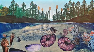
The name of the Panoramic trail "Dolomieu" has been chosen in memory of "Déodat de Dolomieu", a French geologist who, in 179,1 published a study on a limestone rock discovered in the Alps. In his honor, it was called Dolomia. If you want more information on the Dolomia rock and its formation, we invite you read the page we have written on the geological history of the Dolomites:
How to get there
In order to reach the parking lot of Rio Gere It's certainly better if you have your own car, as it allows you to have maximum flexibility. The parking lot is free and very big. It is approximately a fifteen minutes drive from the center of Cortina.
During peak season the risk of finding car parks full is high. Rio Gere is really big, but it is always better to leave early in the morning.
If you don't have a car, you can consider taking the Bus No. 30/31 towards "Passo Tre Croci," with destination Misurina, and get off at the "Rio Gere" stop. It is a seasonal bus, active from mid-June to mid-September, that offers few rides but has good schedules. For more information and to purchase tickets, you should contact the ticket office at the bus station. It may be closed during lunch hours.
Finally, you could consider taking a taxi. From Cortina to Rio Gere the cost should be, approximately, €30. Consider that prices could vary greatly, both for the type of vehicle and the number of people, always ask for a quote. Taxis are found both in Roma Square and the bus station, or you can visit the official taxi website.
For any doubts you may have, you can consult the Tourist Information office in the center of Cortina.
Useful information
The hike along the scenic path dedicated to "Déodat de Dolomieu" is not practicable in winter. The best months for this walk are those that go between May and November. This is a slightly conservative estimate, but unfortunately it's not possible to know in advance when it will snow or when the snow will melt.
If you decide to eat at one of the restaurants described above, the facilities are usually open for most of the year. If you don't want to have bad surprises, in low season, it's always better to call to check the actual opening. In peak season, we recommend arriving for lunch a little earlier than usual to avoid the mess of the rush hours.
If you are not used to mountain hikes, before venturing, we recommend you read the page below:
We want to emphasize that, in the Dolomites, there are rules to be followed. The main ones are:
- It is strictly forbidden to light fires.
- It is strictly forbidden to pick plants and flowers.
- Free camping is prohibited.
- It is prohibited to abandon garbage.
- It is mandatory to keep pets on a leash.
Conclusion
We hope you liked this page on the panoramic trail "Dolomieu." Before saying goodbye, we would like to mention that you can find other amazing hikes in Cortina and its surroundings by clicking here.
If you want to thank us you can read the page Support us. If you only want to suggest a change, propose something or just say hello, in the section contacts and info you'll find all the ways to reach us.