Introduction
On this page you can find some walks to do in winter in the woods of Cortina d'Ampezzo. These hikes are accessible to everyone and are done along trails beaten by snowmobiles or snowcats.

Each hike reaches a mountain lodge where you can eat, can go down by sled and can also be done with ski mountaineering.
In the closing part of the article we'll give some general advice for those who are not very experienced with winter hikings. These suggestions will be about how to dress and how to equip yourself for a walk in the cold of winter season.
Rifugio Mietres
Map

Path of the hike
This hike destination is "Rifugio Mietres" starting from "Guargnè". It's a slightly challenging walk, but still suitable for everyone. The car can be left in the "Guargnè" parking area, where you can see the "Baby" ski slope.

From the parking lot walk north on the only groomed ski slope, where it is virtually impossible to take a wrong turn. Continue uphill, leaving the parking lot and the former swimming pool behind you. After about 15 minutes of walking you'll reach the former chairlift of "Col Tondo", currently closed to the public.

Continue walking up for another 40 minutes, always keeping an eye on the slopes, because of snowmobiles and ski mountaineers who may descend at high speeds.

Once you reach the sign where paths 204 and 211 are marked, after a slight right turn, you are almost there. I don't want to discourage you, but the final climb is quite steep, but pretty short. Don't be fooled by the view of the mountain lodge and continue walking at a constant speed.

Once you reach your destination you'll be welcomed by a cute mountain lodge and a breathtaking view, as well as the opportunity to eat and drink something on the scenic terrace, or inside the mountain lodge. For those who wish it's possible to make this winter hike with mountaineering skis, or you could bring a sledge with you and return sledding on the slope. The use of snowshoes is optional and not recommended.

The "Mietres" mountain lodge also provides service in the evening by reservation, with the possibility of getting on a snowmobile. For this kind of transport we suggest you contact the structure or visit the official website of the Restaurant Mietres.

Malga Ra Stua
Map

The path
This winter trek brings to "Malga Ra Stua" starting from "Sant'Uberto" parking area. It is a easy hike, good for everyone. The parking at the starting point is quite busy and must be reached by car, so we recommend you to leave early in the morning, to have a better chance to find some free car spaces, especially in peak season.

The walk starts from the wooden table of the "Regole d'Ampezzo", which is worth stopping to observe, as it's interesting and very well made. The hike continues in the woods for almost an hour, the road is the only beaten track, so it's almost impossible to get lost.

Watch out for snowmobiles, skiers and sleds. Try to keep to the side of the road throughout the ascent, especially on blind turns. Keep in mind that for most of the walk the climb is constant and not too steep, until almost the end.

Towards the end of the hike, on the left, you can see the famous "Ra Stua" waterfall almost completely frozen. If you decide to approach it to take some pictures, be very careful, the risk of slipping is very high.

One more little effort and you will reach the "Malga Ra Stua", where it's possible to stop, or you could continue towards the "Rifugio Sennes" or the "Rifugio Fodara", a hike usually done on ski mountaineering, but that is also possible to do walking.

If you decide to stop at "Malga Ra Stua", it has about 40 seats inside and 60 outside. The menu consists of typical Ampezzo dishes and traditional homemade food. In addition to the restaurant, the malga also offers bedrooms with shared or private bathrooms. More information can be found on the official website of "Malga Ra Stua".
The mountain lodge has recently changed management, so we have been again, at lunch, to test the quality. We can confirm that we ate very well.
Rifugio Dibona
Map

The path
The "Rifugio Dibona" of Cortina d'Ampezzo is one of the favorite destinations for residents and tourists who want to take a nice winter walk, but without exaggerating. To reach the mountain lodge you have to go up with the car along the "Passo Falzarego" for about nine kilometers, five miles and a half, and park on the gravel parking which is on the left as you go up, shortly after the "locanda Vervei". This place is known with the name of the bus stop, "Cason dei Caai", that can be translated as "Mountain chalet of the Horses".

Parking is unfortunately one of the sore points for those who want to walk to the "Dibona" mountain lodge, so we recommend you to leave early in the morning, to don't have to struggle to find a free parking lot. If the parking is full, you can proceed for another one and a half kilometers, a little less than one mile, you might find a parking space at "Cianzopè". Anyway, we suggest that you don't leave your car on the side of the road, both because it could be dangerous for the other cars, and because you may risk getting a fine.
Once you find a parking space, head towards the start of the road to the "rifugio Dibona", easily recognizable by the many signs and the wooden structure.

After more or less 10 minutes of walking you'll reach the "malghe of Fedaròla". The name of this place derives from "féda", which in Ampezzo means sheep. In fact, in these pastures, the farmers brought their sheeps to graze in the past. Another little curiosity: the locality of "Armentarola", on the Falzarego Pass, takes its name from the dialect word "arménta", which means cow. As you can imagine, in that case it was a cow pasture.

Continue along the road, which besides being the only beaten road, is always well marked. Keep in mind that it's not a very long climb, but in some traits it could be quite steep, so go ahead with a slow and constant pace, in order not to fatigue unnecessarily.

During the first part of the climb you'll be immersed in the woods, but at a certain point the panorama will open up, giving you a splendid view of the Mount "Tofana di Rozes". In about an hour you should see the mountain lodge, which will welcome you with a simple, but high quality menu.

In the past the Dibona mountain lodge used to organize dinners with snowmobiles, but since 2022 it has decided to stop. The decision has been made to allow its guests to have a better relationship with nature without the noise of motor vehicles along the road. As a result of this decision, the closure of the mountain lodge has been anticipated to 4 p.m. and dinners are organized by reservation only. we recommend you to visit their facebook page for more info.
The descent from the mountain lodge will be along the same road, and can be done with a sledge if you bring one with you. If you decide to reach the structure with the ski mountaineering, it's possible to reach the ski slope of the "Tofanina", from which you can reach the locality Socrepes.
Malga Federa
Map

The path
The climb towards "Malga Federa" from "Campo di Sotto" is a quite challenging walk, which will take you seven hundred meters up in constant ascent. This is not a winter hike suitable for everyone, in fact we recommend it only to those who have a minimum of training walking uphill. You can start from "Campo di Sotto" or, if you want to walk a little less uphill, from the wide "Parù de Col" parking lot. If you don't have a car, you can reach "Campo di sotto" walking from the center of Cortina (consider about 30 minutes) or with the city bus number 2.

In peak season the parking lot is assaulted and even "Malga Federa" may not have any available seats, so we recommend you to leave early in the morning, at the cost of arriving too early. I assure you that drinking something with that view will not make you regret this choice. The ascent to the "Malga Federa" is groomed with a snowcat and snowmobiles. The road is always well walkable and it's impossible to get lost. However, try to watch out for sleds and skiers that may go down very fast.

As already mentioned, the climb is quite constant, with a few very steep sections, but also with few flat sections where you can take a breath. We suggest climbing at slow and constant speed. Surely it's a good idea to bring with you the crampons from snow, because in some points the road could be frozen.
After walking for about an hour and a half, the forest will begin to open and you'll see in front of you the "Becco di Mezzodì", indicating that you are almost there. One last effort and "Malga Federa" will be there to welcome you, with a traditional menu of excellent quality and a bar service open until the afternoon. During peak season this mountain lodge also offers the opportunity to dine, however we suggest you check availability on the official website of "Malga Federa". As already mentioned above, the descent can be done walking,with mountaineering skis or sleds, a very fun activity, especially in the evening.
Lake Ajal
Map

The path
Lake Ajal in Cortina d'Ampezzo is somewhere between a restaurant and a mountain lodge. During the winter season 2023/2024 the restaurant will be closed, we have no idea of the conditions of the read and you have to consider that you will have no place to eat or drink.
Because of its distance from the ski slopes and the most traveled roads, it can be reached only on foot, with a walk lasting about an hour, unfortunately all uphill. The faster way to reach Lake Ajal is to leave the car on the wide Parking Lot "Parù de Col". Finding a free space could be a problem, so we recommend that you arrive relatively early in the morning.
To make the walk a little more challenging, we chose to park further down the road, in the locality of "Campo di Sotto", in the parking lot of the power plant, at the beginning of the climb that leads to Lake Pianozes.

The first section is quite steep, we must also be careful of cars and ice, which are often present in this section of the road. In order not to slip, try to keep to the side of the road, where there is always some gravel. At the top of the hill, take the intersection to the right and continue to the Parù de Col car park, it will take approximately 15 minutes.
Once you reach the car park, you'll see the end of the asphalt road and the beginning of a snow-covered road with snowmobile tracks. From there the road is closed to traffic. Even though the route is perfectly signposted, you have to take the road on the right, the less inviting because of the steepest climb. We assure you that the effort will be rewarded with a pleasant lunch. Unfortunately, when we went hiking, there was little snow, as can be seen from the photographs below. At least the road was not icy and we climbed very well. It's always advised to have snow crampons with you, because you may find a different situation. Continue in the only possible direction until you reach an intersection, where you have to go straight. This is a great place to catch some breath, considering that you are more than halfway.

Once you have crossed the intersection, continue for another kilometer, a little more than half a mile, and you'll arrive at the restaurant. It will be clearly visible on your left once you have finished the climb. For those who don't like to walk, the mountain lodge offers snowmobiles service, but we recommend you to contact the structure for more information.

If you are considering the descent with the sled or with the touring skis, consider that it is a very steep road. You have to be very careful with skis, while you should avoid the sled.
Go down by sled
While it's true that in summer the days are long and you can take it easy, winter also has its advantages. The fascination of walking under the snow, the possibility to go down from the mountain lodges with the sledge and the winter atmosphere can transform a simple walk in a moment of great emotion.

All the hikes you'll find on this page have been selected to be made by almost everyone, each walk ends at a mountain lodge, where you can eat or drink something. All the descents can be done sledding or with ski mountaineering.

If you don't want to walk, in some cases, it is possible to call the restaurant and ask for the ascent with snowmobiles. There are fewer and fewer structures organized for this activity, but you may ask. If you are interested, we advise you to call first to check that the service is active.

If you decide to do a night sledding, always remember the head flashlight, with spare batteries. Also remember to use pants with elastic on the ankle, or you'll find yourself with legs full of snow.
If the snowfalls have been heavy, sledding will be fun and quite safe, but if the snow is low you have to be very careful! The presence of ice before the turns makes it more difficult to brake and, if you go off-piste, you risk hitting trees or walls. Be careful, because getting hurt on a sled is easier than you might imagine.
Final thoughts
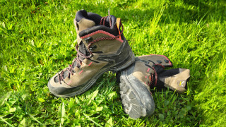
In this final chapter we want to deepen the topic of winter hiking, with some useful advice for those who are not used to going to the mountains in winter. First and foremost, when walking in the snow, it is important to have proper footwear. Shoes should be warm, comfortable, with a sculpted sole and designed for walking on snow.
... Shoes should be warm and comfortable...
Socks must be warm and long, the clothing must be indicated for winter, not too heavy and with the possibility to remove one layer if you feel too warm. If it's very cold, remember to cover your hands and head with gloves and cap. Since you'll be very dressed it's likely that you will sweat a lot, always bring a spare shirt.

It's often possible to find ice, to avoid slipping we strongly recommend the purchase of crampons from snow in a specialized sports store. Sometimes the use of snowshoes is suggested. Personally I recommend you to use this accessory only in case you want to walk in plenty of fresh and soft snow. If you walk on groomed snow they are not recommended, because they only make walking more difficult.

Consider that the ascent in the snow is more tiring than the ascent on asphalt, so bring with you water and a snack, even for short trips. If you plan to stop in a mountain lodge to have fun, always take a head flashlight, the days are short and you may lose track of time, especially when the grappas starts arriving.
Always check the actual opening of the mountain lodge you want to reach: often in the mid-season they only open on weekends. When walking on the groomed snow tracks be aware that there are also snowmobiles, skiers and sleds. Remember that it is forbidden to walk along the ski slopes, both downhill and cross-country. Try to walk on the edge of the road. For the rest, the suggestions are the same that we have given in this page for beginner hikers you can find below:
Conclusion
We hope you liked this page about the best winter hikes in Cortina. Before saying goodbye, we would suggest you read our home page, with all the articles we wrote about Cortina d'Ampezzo.
If you want to thank us you can read the page Support us. If you only want to suggest a change, propose something or just say hello, in the section contacts and info you'll find all the ways to reach us.